Trip Report: Low 2 High Route

Walking through extremes
Tuesday, December 22, 2015

I’ve always been particularly drawn to distinct landscapes and anomalies in geography. This appeal generally acts as the foundation to my pre-trip planning process. If you add the moniker oldest, deepest, biggest, or driest to any descriptor, my interest is instantly piqued. Maybe it’s quintessential Americana, but maybe it’s just the curiosity for the unusual that is inherent in all of us. Take for example Mt Whitney, the tallest peak in the continental United States. At 14,495ft it towers over the Owens Valley, nearly 10,000ft below, acting as a way marker to the Eastern Sierra. Its no wonder Mt Whitney is the most coveted and climbed peaks in the Sierra. As the crow flies, Death Valley National Park lies just 85mi to the east and is the home to the lowest point in the continental United States and holds the record for the highest recorded temperature on earth; a balmy 134F. How do these two extreme landscapes convene? How will these landscapes transition into one another? There is only one true way to answer these questions, thus the Low 2 High Route is born.
The Low 2 High route was largely conceived by fellow adventurer Brett Tucker and is loosely based on the Badwater 135 ultra marathon race. The primary difference being Tucker’s route stays more consistently off roads, links rarely visited canyons and ridges, and is generally the more wild and adventurous of the two. Both routes are roughly 135mi in length, have the same start and end locations, and most notably, marked by extremes in elevation gain and loss; nearly 31,000ft. The sum of which is more climbing than Mt Everest from sea level.
We began our trek in Badwater Basin on October 24th, just two weeks after a record-breaking rain storm deposited 3” of precipitation across Death Valley in just a few hours; 150% above their annual rainfall. In the wake of this flash flood, the former legendary salt flats of Badwater Basin were transformed into tranquil Lake Manly; a rarely seen body of water nearly 2ft in depth. Consequently the start of our route was ironically marked by the longest ford of my life, a three-mile gaunt of mud and muck across Badwater Basin. It was an eerie feeling standing there alone, gazing across this body of water, not entirely sure how deep this ford was going to get. This level of uncertainty would be a constant companion for the remaining miles.
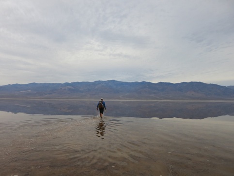
To start the hike we had a 3mi ford across Badwater basin due to the recent flash flooding that occurred in the park. Apparently the rarely seen lake is called 'Lake Manly'.
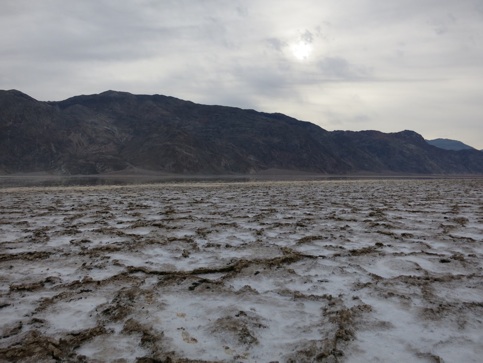
Texture of the 'playa' salt flats in Badwater Basin
Scraping the mud and debris off my Oboz Switchbacks, Telescope Peak stood 11,000ft above us. This cross-country trek up Hanaupah Canyon would be the next waypoint along our route. Hanaupah Spring, 15mi into the trek, would be our first indicator spring to gauge how dependent each of our future water sources might be. Our primary concern was the upcoming 65mi waterless stretch between China Garden Spring and the town of Lone Pine; yet another challenge along the route of extremes.
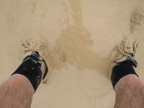
There's a pair of OBOZ under there somewhere! Our 3mi water ford across Badwater Basin quickly turned into an extended 2mi mud slog.
Perched along a ridgetop bluff, exhausted after knocking out 7000ft of continuous climbing, we set up our first of five campsites. Cooking dinner under the evening light, our extended solitude was briefly interrupted by a 400lb bighorn sheep barreling down the ridge side, myself narrowly being trampled by mere feet. Equally startled, the muscular silhouette of the sheep caught its breath and moved on as is nothing had happened. We resumed our dinner as well, content with this exploit that only remote wilderness experiences can present.
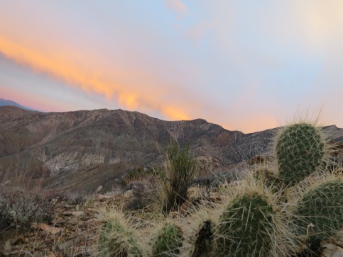
Enjoying the evening light perched along an exposed ridge for the night.
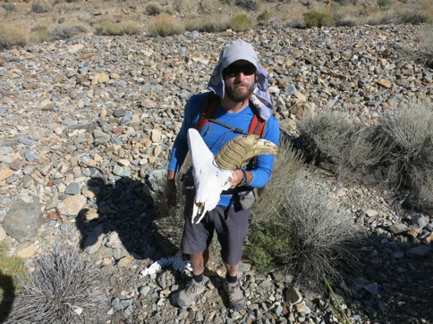
Remains of a bighorn sheep deep within Wildrose Canyon. Likely the distant cousin of the sheep who nearly trampled me the night prior.
The route has an interesting mix of solitude and interface. Along the connecting ridge between Telescope Peak and Rogers Peak, we were greeted by early morning summit-hopefuls. Each friendly hello was juxtaposed by looks of confusion as we dove off the well-manicured trails into a sea of sagebrush along our descent into Wildrose Canyon. This reminder of commonplace clashed against the unfrequented was also present with our discoveries of ancient mining claims, relics, and trinkets along the way. Complete desolation could not have been more present as we traversed the moonscape playa of Panamint Valley, strictly under moonlight.
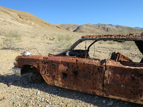
History is lost in the desert. You never know what you're going to stumble across.
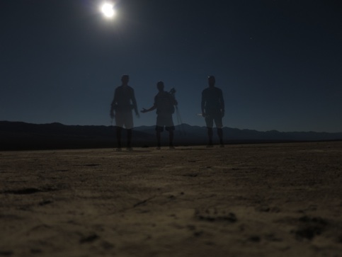
Night shot of us crossing the playa slat flats to beat the heat. We timed the route perfectly with the full moon. It was an amazing experience to hike without headlamp across the barren moonscape.
It’s amazing to me what lies hidden just out of site from commonplace. If you push on, just a little further from where most turn around, the greatest discoveries often exist. Darwin Falls is a classic example of this. Most will do the ¼mi trek to the lower falls and feel content. Few realize that by scrambling past the perceived ‘point of no return’, this level of commitment will relinquish the true pleasures of Darwin Canyon. We stood in awe at how the upper falls had carved a lush line of green over the course of millennia into the barren rock face. Despite our best efforts, the inaccessibility of the tranquil pools below left this beauty best observed from afar. Emerging from the upper limits of the canyon revealed open countryside; vastness best navigated by dead reckoning. We narrowed our sites on a distance landmark, only self-correcting by putting one foot in front of the other.
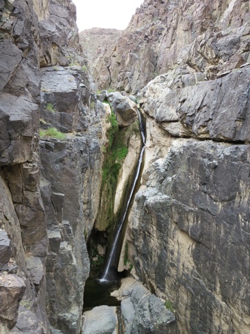
Surprises are around every corner in the desert. This is upper Darwin Falls, a reprise and oasis from the parched landscape.
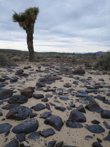
Joshua Tree and typical cross country travel across Death Valley. Its intimidating and freeing to point a point far on the horizon and walk towards it.
By following long forgotten mining roads and right-of-ways we could feel the landscape evolving and taking shape underfoot. Linking into the Inyo Mountains, one gains a rare glimpse of the eastern flank of the Sierra. The abandoned mining town of Cerro Gordo stands as a distant reminder of the boom and glory that these hills once held. The magnitude of the Owens Valley is hard to perceive, let alone translate. From this vantage point we could tick off the silhouette of distant namesakes and recall prior experiences there within; Horseshoe Meadows, Mt Langley, Miter Basin. As the eye moves north progress is palpable as we neared Mt Whitney. I can’t help but think of early pioneers forging their way through this landscape under strict trial and error; the evolution of survival into recreation.
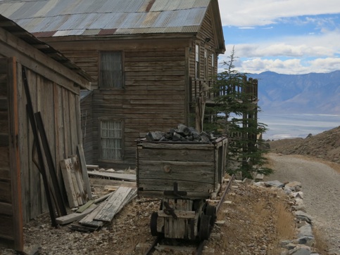
The route passes through the historical ghost town of Cerro Gordo, which was a huge silver mine in the late 1800's. The diversity in landscape and context is prevalent throughout the hike.
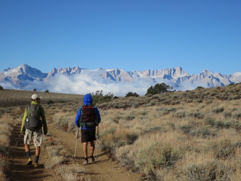
A rarely seen perspective of the High Sierra and Mt Whitney looking across the Owens Valley. The route incorporates long forgotten 4x4 roads to link into the Sierra Nevada.
Pushing the shoulder season into late October, we knew this trip would likely be the last of the season. In thinking of how we wanted to create a bookend to the experience, we opted to explore a few new areas in the Whitney vicinity over culminating on the summit proper. Our route deviated from the Whitney Portal Trail and crossed over Russell Col into the upper reaches of Tulainyo Lake. Atop the col, our descent was punctuated by blustery winds and talus barely blanketed in snow; a dire combination that expedites the urgency of descent. Lower down in Wallace Creek drainage, the impending lure of winter was evident by the hues of amber across the willows. Now well into the alpine, a stark difference to the landscape enveloped us transposed to a mere 100mi ago to the east. As the sun drooped behind a façade of granite peaks, a sense of being the last to exit the Sierra came over me. As we wrapped around into Hitchcock Lakes Basin, I couldn’t help reflect back on the hordes of hikers that descend upon this popular area in the summer. With the last rays of sun hitting Guitar Lake, we had this place to ourselves; a curtain call of sorts and a fitting end to this wild and varied traverse between the lowest and the highest of terrains. As I, this place would lie dormant until spring
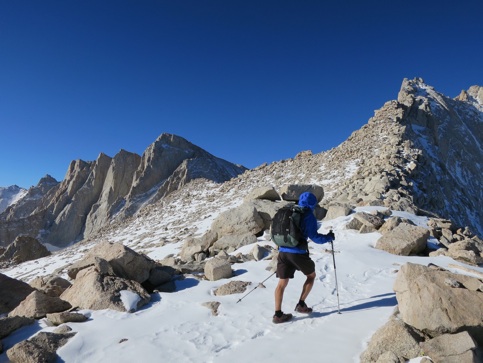
Nacho faces blustery conditions atop Russell Col, Whitney is the high point on the left.
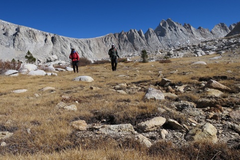
Enjoying the solitude and fall foliage in Wallace Creek drainage.
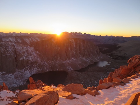
Final sunset illuminating Hitchcock Peak
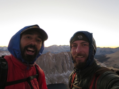
One last look in the Sierra before winter. Nacho and I's parting shot of the High Sierra for the winter.
The start of the Low 2 High route says it all. Nothing but up from here. Only 31,000ft of climbing separates Badwater from the top of Mt Whitney.


